
The photos on this page were obtained in a variety of ways. Some of them are ones I personally own, some were obtained from EBay, and some were obtained from town archives, friends, and some have been donated by visitors to this site. Image quality ranges from excellent to marginal. Images that are smaller and/or of lower quality are ones I do not have originals for. Such images are included as they are better than nothing at all. Many of the images that appear on this page are digital scans from the original prints. I have a strong background in the proper methods of scanning and processing digital images, the results below represent the best I can do without spending hours on each one. Photo credits are given for photos where I know who the photographer was. Many of the images are 50 t0 100+ years old so most of the photographers remain largely unknown.
I am not old enough to have a lot of the first hand knowledge for some of the older photos. If you can add
anything (info, memories, or additional images) they are certainly welcomed! This project started out as a personal undertaking, however it will be much better with input from long time residents! If you want to contribute please
e-mail me. Credits will be given for contributions (or if you want to remain anonymous that is no problem either).
It is possible (because of system memory limitations) that not all of the photos will automatically load. I have verified that all the photos are uploaded. If you are having problems, here's how to force a photo to show: place your cursor over the "blank" picture and right click the mouse. Then click "show picture". This should fix the problem. If problems persist, please e-mail me.
The photos in this section are arranged in the categories listed below.

Introduction: Years ago, North Wilbraham was almost like a separate town. There was a significant amount of business and activity in this part of town. The railroad station was located there, along with the (north Wilbraham) post office, the mills, and a number of other businesses. The photos in this section cover some of these areas.
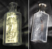 Egan Store Drug Bottle If you had lived in the late 1800s or erly 1900s this is what your prescription bottles (for luquids anyway) would have looked like! I am told that many of the "remedies" back in the day were mostly alchohol based. Bottles are difficult to photograph so I have included two variations here. If you look further down on this page you can see several photos of the old Egan store. It was (the building is still there today) located just across from where the Sonoco station now sits on Boston Rd.
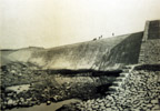
 Red Bridge Dam without Water An undated photo of the Red bridge Dam, probably shortly after its construction.
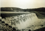
 Red Bridge Dam A view of Red Bridge Dam from the "other" side, looking towards Wilbraham.
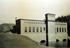
 Red Bridge Dam Power House No date for this photo, probably taken shortly after the facility was built.
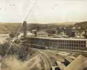
 Mill Complex at North Wilbraham Here's a shot of the mill at North Wilbraham. This shot is looking east. You can see the covered bridge crossing the Chicopee River at the middle left side of the photo. The houses seen in the distance (mostly behind the trees) are houses on Cottage Street. I have no exact date for this photo, however the rail cars that can be seen in the photo look like ones from the late 1800s - early 1900s. This image was taken from a postcard (postmarked at North Wilbraham on July 15 at 5pm, unfortunately there is no year on it. On the back of the postcard someone wrote "This was taken from the tank which you can see in the other photo.". The postacrd had a 1 cent stamp on it.
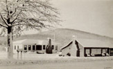 House of Shakers A winter scene of the House of Shakers located on Boston Rd (south side) not too far from the Palmer line, both buildings are still standing in 2007. The big hill in the background is the northern most peak of the Wilbraham Mountains.
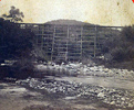 Train Bridge Believe this is the train bridge that goes over 12 Mile Brook. The view is looking south from Rt. 20. No date for this photo... however the trestle is very rickety looking and probably can only handle light (old) loads. This photo was lifted from Ebay. Final bidding went over $70, more than I was willing to pay for one photo!
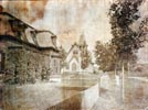
 Maple Street and Grace Union Church Here is a rare photo of Maple Street, looking east. So far as I know Grace Union was built in the late 1870s, so this photo is certainly from after that time. The Victorian house at the left of the photo stands today, it is the one on the corner of Chapel St. and Maple St. Note the lantern at the intersection of Maple St, Chapel St. and Mountain Rd.
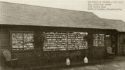 House of Shakers, North Wilbraham An outside view of the House of Shakers. This building still stands in 2007, it is on Boston Road on the right as you head towards Palmer.
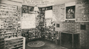 House of Shakers, North Wilbraham An inside view of the House of Shakers.
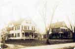 Main Street, North Wilbraham A scene from Main St. in North Wilbraham. I am pretty sure these two houses
still stand (will check it out and report back when I have time).
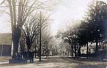 Main Street, Wilbraham A scene looking south toward the center of town. The people standing in the photo are pretty much in front of Rich Hall (Rich Hall is off to the right of this photo).
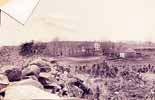 Chestnut Hill Here is a rare photo (wish I had a better resolution on this one). It is looking west towards
Chestnut Hill, the photo was taken from about 700 feet back from Mountain Rd. Chestnut Hill is an area off Mountain Rd about 1/4 mile north of Glendale Rd, there is a road called Chestnut Hill today (however I doubt it existed at
the time this photo was taken). The farmhouse in the distance still stands today (it was built in the late 1700s). Roger Hintze lived in this house for many years. The large barn in this photo is no longer standing. However, a
smaller barn now stands about where this large barn once stood. The foundation from the large barn remains somewhat intact today.
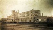 Collins Mill, North Wilbraham An obviously not recent photo of the Collins Mill at North Wilbraham.
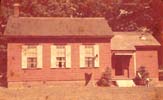
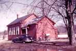
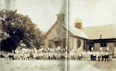 School House, North Wilbraham Here is the school house that now (in 2005) serves as the police station.
Compare this to photos of the same building below! This low resolution image does not show it well, but the kids
are all holding signs that say things like "Eat More Fruit, Drink More Milk, Sleep Long Hours, Eat Fresh Eggs".
This must have been a photo for some kind of health lesson!
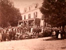 Collins Mill, North Wilbraham A large gathering around Collins Mill at North Wilbraham. I cannot be sure,
but this may have been part of the Centennial Celebration for Wilbraham (can anyone confirm?).
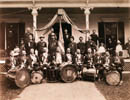 Collins Mill, North Wilbraham The "Moodus Drum and Fife Corps" in front of Collins Inn at North Wilbraham.
Moodus is in CT, the drum shows the date 1860. The group exists to this day: Moodus Drum and Fifes Corps. A visitor to this site writes "My opinion based on the men's clothing and hair styles (and especially those derby or bowler hats worn by several of the men) is that this photo dates from the late 1800s, say maybe 1890 or 1900. Several of the gentlemen standing behind the corps members look to be Civil War vets, wearing their decorations, most likely on Independence Day in Wilbraham". (Thanks Don!)
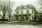 Collins Inn, North Wilbraham The Collins Inn, 1901. Note the Livery Feeding Stable to the left and the house on the hill (in the background), the background house still exists on Chapel St.
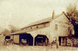 Livery Feeding Stable, North Wilbraham This building, now long gone, used to sit about where the Citgo
Station now sits. No date for this photo, but obviously not recent (see the horse and buggy equipment in the
photo).
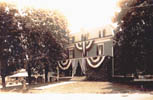 Collins Inn and Livery Stable, North Wilbraham The Collins Inn, at the corner of Chapel Street and Rt. 20.
This building once stood where the parking lot of the Citgo station now sits. To the left the Livery Stable can be
seen. Believe that the Collins Inn was torn down in the 1950s.
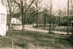
 North Mountain Rd, 1957 A view of Mountain Rd looking south east, this photo was taken just south of the
sharp curve between the Bartlett Ave entrances. The Brown House can be seen just left of center. (Thanks to Larry
for the photo!)
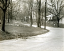
 North Mountain Rd, 1950s A view of Mountain Rd looking approximately west, this photo right near the sharp
curve between the Bartlett Ave entrances. (Thanks to Larry for the photo!)
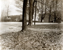
 North Mountain Rd, 1950s The same basic view as above but looking the other way. The Brown House can be seen behind several trees. (Thanks to Larry for the photo!)
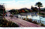 Chicopee River, North Wilbraham An old postcard shot (colorized), probably from the early 1900s.
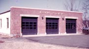
 Fire Station, 1955 Photo by Wilbur Barnes.
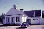
 Town Office, 1955 Photo by Wilbur Barnes.
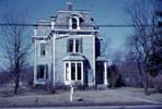
 Library, 1955 Photo by Wilbur Barnes. A visitor to this site provides some additional info: The Barnes
photo of the original Wilbraham Library: it sat just about where the fire station is today - just east of the fire
station. I believe the librarian was Miss Abbott (who puttered around town in a faded tomato-colored 38 Olds sedan), and believe she lived on the upper floors of that building. (Thanks Al!).
 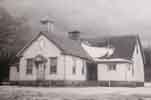 Schoolhouse The school house building that (in 2005) is used as the police station. This photo is believed
to be from the early 1900s.
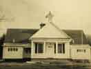 Town Hall Building, 1951 This former school house was used for a number of years as the town hall. Today it
is used as the police station.
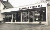 Wilbraham Pharmacy, 1956 The Wilbraham Pharmacy on Boston Road in North Wilbraham. I have nice memories of
this place as a young boy. I used to get film developed through this pharmacy, the old VP-127 roll film. It was so
exciting as a young boy to go down there and see the processed photos! There were only 12 shots on a roll back
then, and 90% of the time all I could afford was black and white. We also used to get chocolate chip cookies from
here on the way home from Saturday religious classes, that was always something (the cookies!) to look forward to!
Note the post office to the left... this was back when North Wilbraham had a separate zip code (01067). I remember
all the complaints when it changed to 01095, everyone who had pre-printed stationary and envelopes had to toss them
out and update them! A contributor to this site adds The Wilbraham Pharmacy was owned by Jim (Joseph) Guenerra
(sp?). The dog on the front sidewalk was named Woodchuck and owned by George Bready of Mountain Rd (Before leash
laws!). (Thanks Larry!).
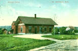 Train Station The train station that used to be in North Wilbraham (about where the Sunoco station now
sits).
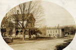
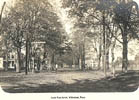
 Chapel Street This shot was taken from the top of what is now known as Chapel Street . Back when this was
actually part of Mountain Rd. The building in the distance at the bottom right is the old post office for North
Wilbraham. The house in the photo still exists today, believe this was a general store for a period of time.
This photo is available on a coffee mug, order number 117. Please click
here for more information!
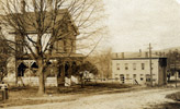
 Chapel Street (closer view) Same basic shot as a above but zoomed in for more detail.
 Depot Square This shot is of the area that is now occupied by the Mobil gas station on Boston Rd (where the
old Skorupski gas station once stood. The house in the background is long gone. This photo is available on a
coffee mug, order number 118. Please click here for more information!
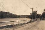
 Boston Road and the Chicopee River circa 1908 Looking east along Boston Road, the Chicopee River is seen.
This photo was taken a little east of where the railroad overpass now sits.
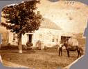
 Morgan House, Mountain Rd. The Morgan House and farm on Mountain Rd, built circa 1822 (photo believed to be
from the late 1800s). The tree in front of the house was cut down in 1970 (due to being very old and in very bad
shape). The horse was named "Topsy". The barn in back of the house fell down in 1933. Over the years this farm
had dairy products and chickens (for eggs).
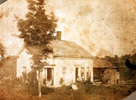
 Morgan House, Mountain Rd. An older view of the Morgan farm.
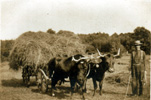
 Morgan Farm, Mountain Rd. A view of oxen, wagon and Mr. Morgan on the Morgan farm.
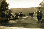
 Morgan Farm, Mountain Rd. Cows grazing at the Morgan farm. Note the total lack of trees on the mountain
ridge.
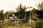
 Monus Konus Bungalow, Mountain Rd. This small house is located just north of the junction of Mountain and
Ridge Rd. Believed to have been built in the early 1900s. The house is standing today. Just across the street is
a cellar hole from what is believed to have been an old blacksmith shop.
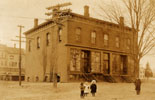
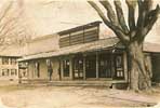
 Post Office at North Wilbraham This is a photo of the old North Wilbraham post office. Up until about 1970
North Wilbraham had its own zip code (01067). This shot of course pre-dates zip codes by many, many years. A close
look at the window of the post office shows that Moxie (an old soda still available today) is apparently sold
within! This photo is available on a coffee mug, order number 119. Please click here for more information!
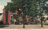
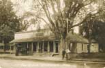
 Egan Store and Post Office Another view of the Egan Store and Post Office.
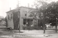
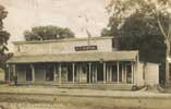
 Logan Store Here's a view of the Logan Store at North Wilbraham, this is the same shot as directly above except at a later date. The sign on the store says "Grocer and News Dealer" and the sign on the tree out front says "Soda and Ice Cream, LUNCH". Look carefully and you can see a woman sitting in one of the doorways. Also note the "Barber Shop" sign in one of the basement windows. There is also a sign for Moxie (an old soda) in the window. An old car sits to the left of the building. It appears that the road in front (Boston Road) may be paved at the time of this photo as there is a concrete water drain visible. I would estimate this photo to be from around 1920 +/-.
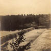 Chicopee River Falls at Ludlow Bridge A view of the dam and falls of the Chicopee River. This shot is taken
from the Ludlow side of the river looking south.
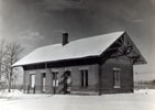
 North Station in Wintertime A photo of the North Train Station after a fresh snowfall. This photo is
available on a coffee mug, order number 121. Please click here for more
information!
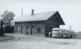
 North Station, July 1962 A photo of the train station at North Wilbraham, July 1962. Compare with photo
above. Believe that these two photos are about the same age based on the surrounding trees.
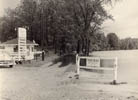
 Nine Mile Pond Food Stand Believe this photo shows the aftermath of the 1955 flood... note the water level
of the pond (up and over the road that circles around part of the pond).
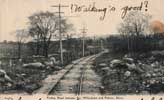
 Trolley Road to Palmer Not sure exactly where this was taken from (looking east or west?).
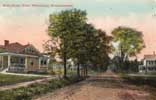 Main Street North Wilbraham Not really certain where this is, possibly a little south of where the police
station is today?
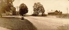
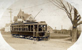
 Route 20 A view of Rt. 20 from around 1900 (?). Photo taken from approximately where the Underpass Saloon
is now located. Note the trolley car and also the horse (under the tree). The only building in this photo that
still exists today is the one at the left. Chapel Street is the road that cuts left off of Rt. 20 in this photo.
And note, sooooo much less traffic than today....
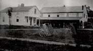
 North Wilbraham circa 1872 This image is from an old (copied) photo. The notations on the original photo are as follows: No. Wilb. Ma around 1872. W. L. Collins house at left. The Legion Club Building stands on this site in 1973. The Collins Livery is at right. The Stone Wall at right still stands intact to this day. In the
foreground the road later became Boston when the underpass was built. Copy by H. Stebbins Wilb.
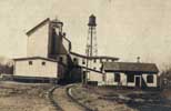
 Cutler Mill North Wilbraham A view of the Cutler Mill at North Wilbraham.
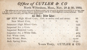
 Cutler Mill Grain Prices from 1883 Things cost a lot less back then... but a good wage was probably $5 a week!.
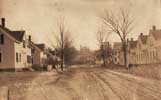
 Cottage Street, North Wilbraham A view of Cottage Street looking North. Several of the mill houses shown
here still stand today. Photo probably from late 1800's.
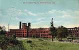
 Collins Mill Collins Mill at North Wilbraham. Much of this complex still stands today.
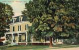
 Collins Hotel The Collins Hotel at North Wilbraham. This was located at the corner of Boston Rd and Chapel
St, just across the street from the train station and the old Post Office. It was (unfortunately) torn down
sometime in the 1950's to make way for what is now an auto service station. In this photo, Chapel Street is seen
heading out of the lower right portion of the image.
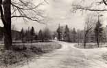 Glendale Road A shot of Glendale Road, looking north (Monson Road is the cross road). The Glendale Cemetery can be partially seen at the left. No date available for this photo, probably 1950s to 1960s.
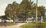
 Wilbraham Auto Inn, North Wilbraham A postcard of the Wilbraham Auto Inn. When I first got this postcard I
was not sure exactly where the Inn was. The postcard is stamped 26 August 1912 and addressed to a Mrs. A. A. Deming in Holyoke MA. The note on the postcard reads "We have just had dinner here, and a fine dinner it was,
Kate". A visitor to this site also offered some valuable details on the Auto Inn: Auto Inn was on Rt. 20
across the road from 9-mile pond, kind of next to Luzi's Autobody. I think it burned down in the late 50s or early 60s. It was called Sullivan's Auto Inn at the time, and was owned by two brothers, Bart and Buddy Sullivan. Bart
and family lived on premises; Buddy and family lived in a house directly behind the Inn, which may still be there.
It was operated as a tavern/tap room in the 40s and 50s, with functions (dances and so forth) Friday evenings. In the summertime, everybody swam at Nine Mile, near where the picture of the ice cream stand is (see "Nine Mile Pond Food Stand" photo above). If it was particularly hot, those of age would "hot-foot-it" across Boston Rd, go to the back door of the Inn, and return with cold beverages." (Thanks Al!)
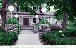 Wilbraham Auto Inn, North Wilbraham A view of the entrance of the Auto Inn.
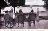 Wilbraham Auto Inn, North Wilbraham Three men enjoying the view from the front porch of the Auto Inn. This view is basically looking south over Nine Mile Pond. Note that the postcard calls this "Manchonis Lake".
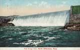 Red Bridge Dam, 1907 A view of Red Bridge Dam at North Wilbraham, circa 1907.
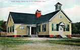
 Old School House, District No. 8 This school house is the building that is now used as the town's police
station (located at the east end of Main St.).
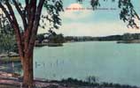 Nine Mile Pond A view of Nine Mile Pond. Not sure from where on shore this was originally photographed.
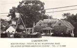
 Lakeside Inn Here is a photo (actually a postcard) of the Lakeside Inn on Rt. 20 (Boston Rd.). Exact date of
photo is not known, my guess would be sometime in the late 1950's or early 1960's. Note the large "pot" in front of
the restaurant.. this has been gone for many, many years now. A visitor to the site wrote The Lakeside was
owned by a fella named Jake Grole (not sure of the spelling, but that's what it sounded like). The photo you have
of the bathing beach behind the Lakeside (see photo just below) was called the Beer Garden. You could swim, get
food from the grill they had just off the Beer Garden, and of course get your favorite beverage from the small bar
they had downstairs there. I believe Jake's daughter ran the bar and grill downstairs there at the Beer Garden. It was a great little beach, and they had a raft/float you could swim out to, and back. (Thanks Al!). A high school classmate was able to subsequently provide some clarifications on the names of the people who owned the restaurant back then: Jacob and Fanny (Zimmerman) Groll.
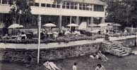 Lakeside Inn (back view) A view of the rear side of the Lakeside Inn. Back in the 1950's there was a
bathing beach in back of the Lakeside!
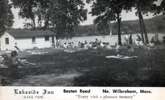 Lakeside Inn (beach view) A view of sun bathers at Lakeside!
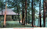 Manchonis Club House Don't have a lot of info on this, suspect that is Nine Mile Pond on the right.
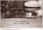 Lake View House This is apparently the same building as the "Auto Inn" shown elsewhere on this page. ... almost certainly the "lake" is Nine Mile Pond.

Introduction: The Wilbraham and Monson Academy has been around since the mid 1800's (and has had a number of names over that period). The Academy is one of the most historical sites in town. There are a large number of old photographs associated with the academy, many of them featuring subjects not actually on the academy grounds.
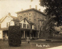 Rich Hall and House Here's a photo of Rich Hall and the house that lies just to the south of it.
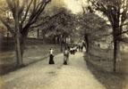
 Students on the Broad Walk No date for this photo but obviously not recent!
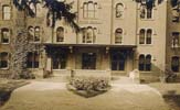 Rich Hall Main Entrance A shot of the main entrance to Rich Hall.
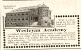 Wilbraham (Wesleyan) Academy Ad Here is an ad for Wilbraham Academy. Believe this is from the late 1800's... tuition for the year is only $250.00!
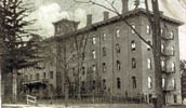 Rich Hall Rich Hall of the Wilbraham Academy.
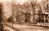
 Rich Hall and Principle's Residence A view of the main building of the Wilbraham Academy. This photo was
taken from the 1890 Wilbraham Academy Yearbook. This photo is available on a coffee mug, order number 102. Please click here for more information!
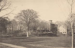
 Wilbraham Academy More of the Wilbraham Academy buildings. This photo was taken from the 1890 Wilbraham
Academy Yearbook. This photo is available on a coffee mug, order number 103. Please click here for more information!
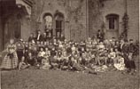
 Wilbraham Academy Students The Junior (possibly senior) class of the Wilbraham Academy, 1890. This photo
was taken from the 1890 Wilbraham Academy Yearbook. This photo is available on a coffee mug, order number 104.
Please click here for more information!
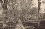
 Wilbraham Academy Grounds A view of one of the walkways of the Wilbraham Academy. This photo was taken from the 1890 Wilbraham Academy Yearbook. This photo is available on a coffee mug, order number 105. Please click here for more information!
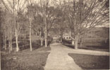
 Wilbraham Academy Grounds A view of another walkway of the Wilbraham Academy. This photo was taken from the 1890 Wilbraham Academy Yearbook. This photo is available on a coffee mug, order number 106. Please click here for more information!
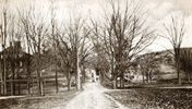
 Broad Walk Another view of the walkway on the Academy grounds.
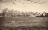
 Wilbraham Academy Athletic Field A view of the Wilbraham Academy athletic field. This view is looking to
the northwest, houses on Main Street can be seen. The ditch running across the field is the stream, this stream is
essentially the same today as it was back then. This photo was taken from the 1890 Wilbraham Academy Yearbook.
This photo is available on a coffee mug, order number 107. Please click
here for more information!

 Wilbraham Academy Athletic Field Close Up Same basic image as above, but a closer view. Note the houses
along Main St. This is a wide image, be sure to use the drag bar to see all of it!
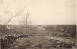
 Wilbraham Academy from the Mountain A view of Wilbraham Academy as seen from Wilbraham Mountain. This view
is looking west. Seen in this photo is what appears to be recently turned earth, running in a line that appears to be a ditch. I suspect that this may have been the ditch that was dug to lay the water pipeline from the Upper
Reservoir down to the center area of town. I cannot confirm this as yet, more research is needed. Mountain Road
can be seen in this photo (fence runs along it). This photo was taken from the 1890 Wilbraham Academy Yearbook.
This photo is available on a coffee mug, order number 110. Please click
here for more information!
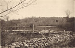
 Wilbraham Academy Lower Reservoir Here is a photo of the Wilbraham Academy Lower Reservoir. Note that the
mountain in the background is largely devoid of trees (as was common back then). This reservoir still exists today, although the dam is in bad shape. Compare this photo to this one
(which is a modern view of roughly the same shot) to see what 110 years can do to disguise an area! The old photo
was taken from the 1890 Wilbraham Academy Yearbook. This photo is available on a coffee mug, order number 111.
Please click here for more information!
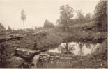
 Wilbraham Academy Upper Reservoir This is a photo of the Wilbraham Academy Upper Reservoir. When I first
obtained this photo, I did not recognize it as such, because the area is so remarkably different today! Note that
there are very few trees; today the area is totally forested. The dam in this photo is smaller than what exists
today, at some point after this photo was taken (around 1890) the dam was built up higher. The water level today is definitely higher. This photo was positively identified as the Upper Reservoir by looking at the rock structures:
they have not changed over the years. Compare this photo to this
one (which is a modern view of the same shot) to see what 110 years can do to disguise an area! The old photo
was taken from the 1890 Wilbraham Academy Yearbook. This photo is available on a coffee mug, order number 112.
Please click here for more information!
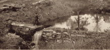
 Wilbraham Academy Upper Reservoir, Dam close up Same basic image as above, but zoomed in on the dam.
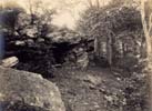 The "Cave" at the Upper Reservoir A shot of the "cave" (not really a cave, it is actually an outcropping of
rock that forms a shelter underneath). No date for this photo, suspect circa 1909 (see image below).
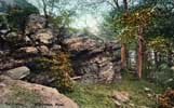
 The "Grotto" at the Upper Reservoir Another view of the "cave" at the Academy Upper Reservoir, circa 1909.
This image appears to be a colorized version of the image just above.
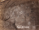
 Class Monograms 1906 Class Monograms from long ago. Not sure where on the Academy grounds these are located, but I would not at be at all surprised if they are all still there today!
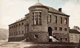
 Academy Gymnasium Building A photos of the gymnasium building located on the Academy grounds. Compare this
old photo with a modern one this one!
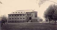
 Smith Hall Smith Hall (gymnasium) of the Wilbraham Academy, a view looking to the south.
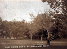 Old Maid Seat A resting place on the grounds of the Academy.
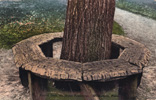 Round Seat Another resting place on the grounds of the Academy.
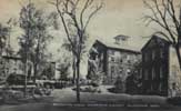 Recitation Halls at Wilbraham Academy A view of several of the buildings on the grounds of the Academy.
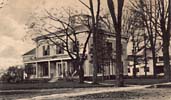
 Wilbraham Academy Principal's Residence This is the house that sits just opposite of Rich Hall on the corner of Main and Faculty Streets. No data available for this photo, but it is probably from the early 1900's. This
photo is available on a coffee mug, order number 116. Please click here for
more information!
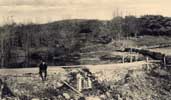
 Lower Reservoir Another shot of the Wilbraham Academy Lower Reservoir (compare to similar shots elsewhere on this page). This photo is available on a coffee mug, order number 120. Please click here for more information!
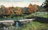
 Lower Reservoir circa 1911 A colorized shot of the Lower Reservoir, circa 1911.
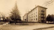
 Rich Hall Rich Hall of the Wilbraham Academy, this view looking to the south. No date for this photo,
probably the early 1900's.
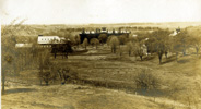
 Distant View of Rich Hall A view of Rich Hall from up on the mountain. The
road visible at the lower right is Mountain Rd. Note that much of the land in the background is cleared of trees.
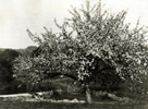
 Blooming Tree at Lower Reservoir What looks to be an apple tree in full bloom at the Lower Reservoir. Also
it looks like the top of the dam has been covered over with concrete. No age for this photo but obviously not
recent!
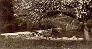
 Close up of Lower Reservoir Waterfall A zoomed in shot of the one just above.
 Old Pump Believe this old fashioned hand pump was located at the Academy Lower Reservoir.
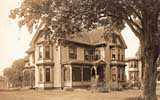
 Nellie Starr House This is the Nellie Starr house, on Main Street, it is one of the houses associated with
the Wilbraham Academy. (thanks Jay!)
 Wilbraham Academy Playing Field A view of the playing field at the Wilbraham Academy. This shot was taken
looking northeast from approximately the intersection of Main and Faculty streets.
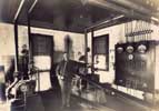
 Equipment Room I originally thought this was a bolier room, however a gentlemen e-mailed me and stated the machinery was actually a compressor. This photo is presented in large format. Check out the uninsulated electrical switches on the wall!
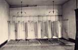
 Bathing Room A view of an indoor bathing facility at the Academy.
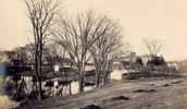
 Behind Rich Hall A view of the area behind (to the west of) Rich Hall of the Academy. This photo is presented on extra large format, take a close look at the fine details (including many chickens running around the area)! Most of the
farm buildings shown here are no longer standing, and they could not be replaced today even if someone wanted to due to
wetland laws.
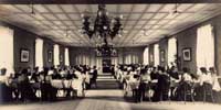
 Dining Hall A view of a dining hall at the Academy.
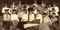
 Girls Class I have no idea of what year this class is (obviously not recent). The original photo shows many
fine details of clothing of the period!.
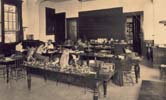
 Laboratory Classroom A view of a laboratory at the Academy. Note the specimens of various birds sitting on the table.
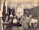
 Girls Dorm Room A view of life in the girls dorm. This photo is presented in large format... take a look at the detailed furnishings in the room... no Ipod, no computers, no TV, etc!
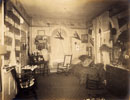
 Lady's Dorm A view of another dorm room. Based on the banner (it says '04') this photo is likely after 1904.
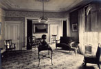
 Sitting Room Not sure what building this was in, possibly Rich Hall?
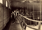
 Gym Walkway A view of a walking platform inside Smith Hall.
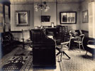
 Head Master's Office Note the antiquated typewriter on the desk at the right of the photo... this was probably a "state of the art" unit at the time!

 Gym Walkway A view of a walking platform inside Smith Hall.
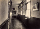
 Hallway A hallway somewhere on the Acedemy grounds.
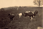
 Cows at the Academy Believe this photo was taken from the lower portion of Mountain Road looking to the left as you are heading up the mountain.
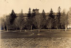
 Rich Hall A view of Rich Hall. Looks like the remnants of a small cornfield in the foreground of this photo.
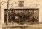
 Academy Building A view of one of the academy buildings.

Introduction: This section contains old photos from in and around the center of town.
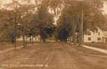
 Main St. looking South from the Town Center This is a view lookng south from the center of town. The road going off to the right (out of the photo) is Springfield St. Note that the roads are all dirt, however the sidewalk on the west (right) side of Main St. looks like it is paved (possibly concrete)! The house shown in the right of the photo still stands in 2008. No exact date for this photo; however the postcard it was taken from is postmarked 12 June 1916 so the photo can't be any newer than that date!
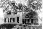 House at 582 Main St. An undated photo of the farm house located at 582 Main St (not too far from Minnechaug). This photo (and the 2 below) were sent to me by a visitor to the site, I was terribly slow in getting them posted!
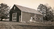 Barn at 582 Main St. The barn that sits near the house in the photo just above.
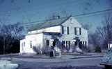
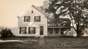 House at 582 Main St. A newer photo of the house at 582 Main St. Note the missing tree, the new door, the lack of a fence and changes to the woodwork on the porch.
 Post Office, 1955 Photo by Wilbur Barnes. I wasn't certain where this was located, but a visitor to this
site wrote The picture of the old post office............ah, that was located at the corner of Main and
Springfield Streets......where the brick building now sits. I can remember when I was a student (2nd grade -
1949/50) at the Springfield St school.............being sent to the post office to buy a block of savings bond
stamps for the school to resell. Yes, in those days, you bought savings stamps in ten-cent denominations, pasted
them into your savings book, and when you had $18.75 of them, you got a $25 bond. Note that the post office was only the small part of the building. The larger part was I think maybe the Mason's hall. I went to kindergarten and
nursery school on the first floor there. Carol Ryder (later Carol Beech) ran the nursery/kindergarten there.
(Thanks Al!). I should have recognized this building... there are several other older shots of it below (the F.A.
Gurney store)!
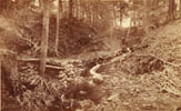
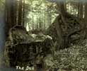
 The Dell A very old photo I picked up... believe this is the stream that runs along side Woodland Dell Road
near the center of town. Note the man standing towards the back of the scene.
 The Dell Another view of the area known as the Dell. This image was donated by a visitor of this site.
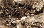
 The Dell Another view of the stream at the Dell.

 Soldier's Monument, 1955 Photo by Wilbur Barnes.
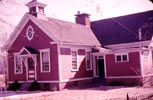
 Springfield Street School, 1955 Photo by Wilbur Barnes. A visitor to this site wrote "Llewellyn Merrick says this school was known as the #4 school and sometimes called the Center School. It was painted yellow with brown trim and he attended the school in 1940. Millicent Green was the principal and also taught 5th grade. Her husband Milo Green ran the filling station on the corner of Springfield Street. The Little Red School House was also known as the Mile Tree School at the intersection of Main St. and Tinkham Road, now the Childrens' Museum.
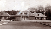 Wilbraham Library, 1976 A view of the Library as it looked in 1976.
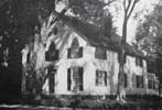
 Post Office, 1958 Here is the "new" post office (new for the time) at the center of town.
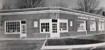 Wilbraham Center, 1958 At left is a barber shop; barbers were Nick (the owner) and Chic (second barber).
Next is the Stearns Real Estate Office. The hardware store was co-owned by Walt McCarthy & Fran Sheehan. At the
far right is the drug store, then owned by Walt Salustri (Thanks Larry for the info!.
 Memorial School, 1950 Memorial School shortly after construction in 1950. Note that the east wing of the
school has not yet been added!
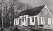
 Old Meeting House, 1951 A photo of the Old Meeting House from 1951. Not the best quality image, but I
included it because the view is so nice with the large trees.
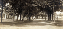
 Main St. looking north from Faculty St. Note how many trees line Main Street in this photo. Also note that one of the utility poles has a very early street lamp. Academy houses can bee seen to the left and the academy playing field is on the right of the street.
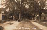
 Wilbraham Center A shot of Wilbraham Center, obviously quite old, looking north. The old Post Office (now
the Village Store) is seen at right, and parts of the Old Meeting House can just be made out through the trees.
Note that none of the buildings seen on the left exist today. The building at the left is (or was or became) the F.
A Gurney store (see below for more pictures of that structure). Springfield Street can be seen heading out of the
left of the picture.
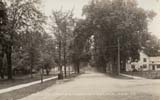
 Main Street Looking South This view of Main Street is about 180 degrees from the view in the above photo.
Springfield St. heads out of the right of the photo.
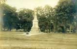 Soldier's Monument A marginal quality shot of the Soldier's Monument located at the town center.
 Main St. Wilbraham A view of Main Street looking north from approximately in front of Faculty Street.
 Post Office (center of town) The Wilbraham Post Office. Some people may recognize this building as the
Village Store in the center of town today. The house in the background is still standing in 2001.
 Post Office (center of town) A slightly newer (as compared to the image just above) picture of the post
office at the center of town. The sign on the store appears to say "F.A. Gurney"; however, the F.A Gurney store was at one time across the street. Notice that the tree is larger and there are also power lines present.
 Post Office (center of town) A yet newer (as compared to the image just above) picture of the post office at
the center of town. The tree is now cut down. The sign on the store says "FC Newton"; possibly F.A Gurney moved
across the street and F.C Newton took over this place? Also note the two men standing near the pole and the horse
and buggy in front of the building.
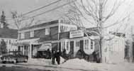 Village Store, 1952 The Village Store at the center of town (obviously much newer than the photos above).
Note the "Wilbraham Branch of Ludlow Savings Bank" at the right end of this building.
 Village Store Back Room? I am not exactly sure, but this photo is believed to be one of the inside of the
back room of the old village store.
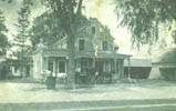 F.A. Gurney Store The F.A. Gurney store. This was located where the center drugstore is now. The entrance to Springfield Street is just out of the scene to the left of the building.
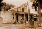 F.A. Gurney Store Another photo of the F. A. Gurney store (located where Lewis and Clark drugs is today).
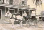 F.A. Gurney Store Horse and Wagon A photo of a horse and wagon (and driver) in front of the F.A. Gurney
Store. Note the Soldier's Monument is visible in the right third of the photo. This photo was taken looking approximately east. ALso note the muddy road, no pavement in those days!
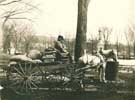 F.A. Gurney Store Horse and Wagon A wintry photo of a horse and wagon (and driver) from the F.A. Gurney
Store. The horse is drinking water in preparation for a delivery? Note the contents on the wagon. Also note the
Soldier's Monument in the background. Also note the relative lack of vegetation on the mountain in the background.
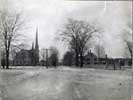 Main Street, looking South from Town Center a view of Main Street looking to the south as seen from the
center of town. Springfield Street head out of the right of the picture. The church on the left side of Main
Street has been gone for many years.
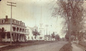
 Main Street Wilbraham Main Street in Wilbraham about 1888. This photo was taken looking south from
Springfield St. The first two buildings at the left of the photo have been gone for many years (the church was located about where Gazebo Park is today). The church was built in 1877 but later burned in 1911.
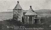 Wilbraham Mountain Spring Water Co. This is the source of water for the Wilbraham Mountain Spring Water Co. In 2009 I asked Jesse Rice if he knew anything about this, he said "I know exactly where it was located". It was located west of the Acedemy, between Faculty and Springfield Streets, kind of down the hill from the playing fields (the white circle on this map shows the area where it used to be). I have one of the bottles from this water company, believe they are quite rare at this point in time. I found it while bottle hunting in 1980 in a dump at the end of what is now Webster Lane.
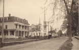
 Main Street Wilbraham A view of Main Street in Wilbraham. This is the view looking south as seen from
roughly the intersection of Main and Springfield Street. This photo is similar (but not identical) to one other
posted on this page. All but one of the buildings seen here are gone today. This photo was taken from the 1890
Wilbraham Academy Yearbook. The church was built in 1877 but later burned in 1911. This photo is available on a coffee mug, order number 109. Please click here for more information!
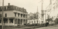
 Main Street Wilbraham Close Up Same basic photo as above, but zoomed in for a closer view. Note the people and the horse and buggy.
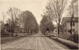
 Main Street Wilbraham A view of Main Street looking south from approximately in front of Wright Place. This
photo was taken from the 1890 Wilbraham Academy Yearbook. This photo is available on a coffee mug, order number
113. Please click here for more information!
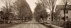
 Main Street Wilbraham, Close up view Same view as above but zoomed in for a closer look at the houses. Also note what looks like tire tracks on the dirt road Main Street!
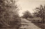
 Mountain Rd. A view of Mountain Road looking west. This photo was taken from approximately the location
just south of where the stream crosses the road (on the end of Mountain Road towards the center of town). Remnants
of barbed wire fencing can be found along the road today. This photo was taken from the 1890 Wilbraham Academy
Yearbook. This photo is available on a coffee mug, order number 114. Please click here for more information!
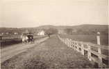
 Faculty Street A view of Faculty Street looking to the east. Notice how narrow the road is as compared to
today. Also note the large patches of grassy area on the mountain (much of the mountain was used for grazing land
back then). This photo was taken from the 1890 Wilbraham Academy Yearbook. This photo is available on a coffee
mug, order number 115. Please click here for more information!

Introduction: This section contains old photos of churches in Wilbraham.
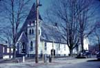
 Grace Union Church, 1955 Photo circa 1955 by Wilbur Barnes. Note the island at the intersection of Chapel St, Maple St. and Mountain Rd (not there today). Also notice the old fashioned street light with the "pie tin" style
reflector!
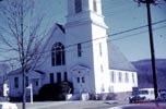
 United Church, 1955 Photo by Wilbur Barnes.
 United Church, 1955 Photo by Wilbur Barnes.

 Academy Chapel, 1955 Photo circa 1955 by Wilbur Barnes.
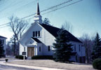
 St. Cecilia's Church, 1955 Photo by Wilbur Barnes. Note that this is the original St. Cecilia's Church, at
the intersection of Main St. and Boston Rd. Today the building is the home of New England Promotional Marketing (www.nepm.com).
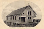
 St. Cecilia's Church Here is a photo of St. Cecilia's Church on Main Street. Date is approximately 1890...
note that this building is NOT the same one as the modern St. Cecilia's church. The building shown here is the one
that is at the corner of Main St. and Boston Rd (no longer a church, it is the home of New England Promotional Marketing). This
photo is available on a coffee mug, order number 100. Please click here for
more information!
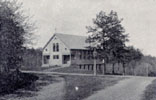 Original St. Cecilia's Church at corner of Main St. and Boston Road Here's a shot of the junction of Main
St, Maple Street and Boston Rd that shows the original St. Cecilia's Church. Note the complete lack of traffic as
we have today! Photo not the greatest quality (scanned from a newspaper).

 Congregational Church This Church (no longer standing today) was located just south of the center of town on
the east side of Main St. It was built in 1877 and burned down in 1911. It was replaced by the church in the photo just below. It was located about where Gazebo Park is today.
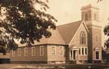
 Wilbraham United Church The Wilbraham United Church. No exact date for this photo, but has to be between
1913 and 1958 (this building was replaced by a newer, larger building around 1958).
 Wilbraham United Church This photo of the Wilbraham United Church is from approximately 1953. This building
is no longer standing today (replaced by the new Wilbraham United Church). Photo courtesy of Jeffrey R. Wood
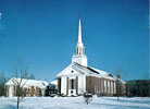 Wilbraham United Church, 1965 Wilbraham United Church, photographed in 1965 shortly after completion of the
Fellowship Hall addition. Note
the decorative finials atop the steeple base; these have been absent for many years. (Information and photo courtesy of Jeffrey R. Wood)
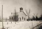
 Glendale Road Church Nice winter scene of the Glendale Church. No date for this photo... early to mid 1900's maybe? Compare this photo to this modern one . Fortunately, this historic church was spared from the potential loss at that hand of some teenaged punks who tried to burn it down in December 1980. Unfortunately, around 2005 this church disbanded, believe the buidling was up for sale.
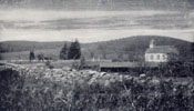 Glendale Road Church and Wilbraham Mountain Here is a shot of the Glendale Church (note the Glendale
Cemetery also visible). Wilbraham Mountain is in the background. Photo not the greatest quality (scanned from a
newspaper).
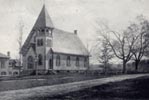 Grace Union Church A shot of Grace Union Church at the corner of Maple St., Chapel St. and Mountain Rd.
Note the lack of trees in the background as compared to today. Believe this church was built in the 1870's. Photo
not the greatest quality (scanned from a newspaper)..
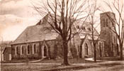
 Methodist Church The church at the corner of Main St. and Mountain Rd. No date for this photo, but suspect
it is the early 1900's based on the treeless mountain in the background. Church was built in 1870. This photo is
available on a coffee mug, order number 101. Please click here for more
information!
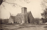
 Methodist Church The church on the corner of Main Street and Mountain Rd. This view is looking to the north east. This photo was taken from the 1890 Wilbraham Academy Yearbook. This photo is available on a coffee mug,
order number 108. Please click here for more information!
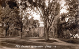
 Methodist Church circa 1913 The same basic view as the photo above, but a number of years later (as can be
determined from the size of the trees in the two photos).
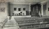
 Chapel Inside circa 1914 An inside view of yet to be identified church, circa 1914. The following info was
provided by a visitor to the Mass Live Wilbraham Forum: "The Silver Street Chapel". I'm familiar with it outside but not inside, and it is on the Monson side of the line.
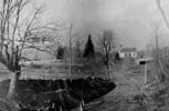 Glendale Church, 1913 A photo of Glendale Church from 1913. Photo contributed by Bruce Tingle. Picture from a collection of Henry Edson, author of a couple of Glendale memoirs and the creator of a large historical map
hanging in Town Office.
.

Introduction: This section contains miscellaneous photos; these may include photos that do not easily fit into the other categories, or ones I have not identified as of yet.
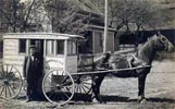 Bible Cart A presumably rare photo of F.M. Robbins of Wilbraham. At time of writing I have no other info on this photo.
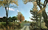 Unknown Farm Scene This scene is definitely from Wilbraham, however I have no idea where in town it is. Can anyone provide info?
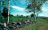 Unknown Farm Scene This scene is definitely from Wilbraham, however I have no idea where in town it is. Possibly it is North Wilbraham? Can anyone provide info?
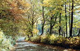 Unknown Country Road Scene This scene is definitely from Wilbraham, however I have no idea where in town it is. Can anyone provide info?
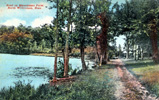 Minachogue Farm Scene This farm is in North Wilbraham according to the postcard. I do not know where exactly in town this was (maybe still is?). Can anyone help with info?
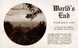 World's End Restaurant I wasn't sure where this was, however a visitor to the site wrote "The Worlds End was located on Burleigh Road, almost to the Hampden line. It was rumored to be a speak-easy during prohibition and was destroyed by fire, sometime in the 30's I believe. I knew the family who used to live on the property and they built part of their house on the old foundation. A beautiful spot!" (Thanks for the info!)
.
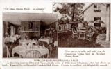 World's End Restaurant The card says "1800 feet above sea level", I guess they did not have accurate measurement techniques back then as the highest point in Wilbraham is considerably less than 1800 feet...
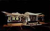 K's Restaurant The restaurant now known as Gregory's (or better known by some as "Pizza Pub"). This photo is probably from the late 50s or early 60s.
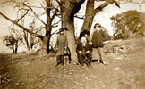
 People on Wilbraham Mountain, October 1920 I do not know where on the mountain this was taken... probably not too far up as the man in the chair has a cane (and probably not able to trek too far out). Note the dog on the
leash.
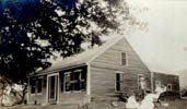 Mile Oak Farm I am not even sure if this farm was in Wilbraham, I assume it was as this photo was found among many other old Wilbraham photos. It looks similar to an existing old house on Main St. Does anyone know for sure
where it was?
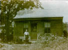 Unknown House I am not sure where this house was (is). There (up until a few years ago) was a similar house
on North Mountain Road but I am not sure this is the same house. All of the photos found with this one were of
subjects in North Wilbraham so I assume this house was somewhere around there too. Can anyone confirm?
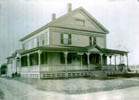 Unknown House I am not sure where this house was (is). This house looks similar to an existing one on Main
St (near Memorial School), but in this photo the mountain in the background seems to be missing so I am not yet sure about where it was (is). The sign on the house says "DRESS MAKING" and another sign says "MILLINERY". All of the
photos found with this one were of subjects in North Wilbraham so I assume this house was somewhere around there
too. Can anyone confirm?
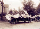 Second Prize, 1955 The verbiage on the back of this photo says "Second Prize, 100th anniversary, EL
Thompson". I am not sure what 100th anniversary this was, I doubt 1863 as I don't believe cars like the one shown
here existed at that time. The original hi resolution scan shows that the license plate on one of the cars is the
old, heavy metal ceramic coated type in use in the early 1900s. The sign in this photo shows that Wilbraham Academy is 2 miles away, Springfield is 10 miles, and Indian Orchard is 5 miles (it also shows Wilbraham as 2 miles, I am
guessing this means the photo was taken in North Wilbraham).
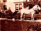 Warren L. Collins A photo (with labeling on back) indicating that this is Warren L. Collins, with his horse
and buggy and what appears to be a black man in the back. Almost certainly this person is associated in a major way with the Collins Mill and Collins Inn.
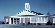
 Memorial School, 1955 Photo by Wilbur Barnes.
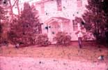
 Legion Hall The Legion Hall, circa 1955. Photo by Wilbur Barnes.
 Community Tree, 1954 The community Tree, 1954, photo by Wilbur Barnes.
 Edmund Barnes House, Main St, circa 1955 Photo by Wilbur Barnes.
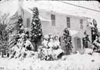
 Edmund Barnes House, Main St, circa 1955 Photo by Wilbur Barnes. Note significant snow!
 Legion Hall, 1955 Photo by Wilbur Barnes. Original slide notes: "while occupied by burned out family".
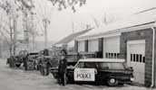 Police, 1958 Not sure exactly where this was taken, but it clearly shows an older police car. A visitor to
this page writes building in picture is garage in highway dept looking towards Boston
Road. Second building behind that was the water dept building. Another visitor provided names of the people.
From left to right: Norm Farnsworth, Herb Butler, John Piscor, Chief Robert Dietz (thanks Larry)!
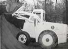 Loader, 1956 A new loader for the town circa 1956. This old equipment was built so well I would not be
surprised to learn that this piece is still working today on some small farm...
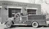 >
Fire Truck, 1958 A 1956 Ward 300 Fire Truck (info provided by Richard Cochran who started in the dept in 1962 and made rank of 1 st Lieutenant [32 years on the dept]).
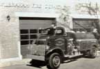 Tank Truck, 1958 A 1952 or 53 Chevy 6 cylinder gas powered tank truck, which was later converted to diesel. It was once an oil truck owned by Buddy Tupper ( Tupper Oil ), before it started service in the Wilbraham Fire Dept. It was later bought by Rice’s Fruit Farm for a spray truck. It may still be there to this day in there garage. (info provided by Richard Cochran who started in the dept in 1962 and made rank of 1 st Lieutenant [32 years on the dept]). Another gentleman provided the following info on this truck: "Hi Joe, I thought I would respond on this Fire Truck it would be a Chevrolet from 1941 to 1947 Cab Over Engine and being that it is a 4 wheel drive it more that likely was world war 2 1943 to 1944 no stainless on the grille." (Info provided by Bill White, Retired GM Training Center).
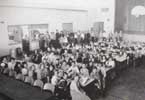 Pines School, 1953. Students at lunch in the cafeteria. When I attended this school (in the 1960s) this room was the gym/auditorium. There was a new cafeteria when I was there. I remember some parts of this school being
fairly old back then. I have many memories of eating lunch in the (new) cafeteria at this school. The lunch ladies would have the lunches (especially when soup was served) already set up at the tables for the first graders (they
must have figured it was less work to set up the lunch beforehand as compared to cleaning up all the spillage that
would inevitably occur with 5 and 6 year olds trying to carry trays with bowls of soup on them!). Back then, a
carton of milk was 2 cents (that was the amount of "milk money" you had to bring). I also remember that a lot of
kids would not eat the crust on the bread (for reasons I never understood). There was a custodian that would always take the bread crust from the kids when they were taking their trays up to the garbage can area. He would toss the crusts out the door so the birds could have it. I can't recall his name (does anyone remember)? Back then the
principal was Mrs. Straus. When the kids were getting out of hand, she'd come into the cafeteria and BOY would
things calm down in a hurry! No one DARED step out of line back then. If you were only being a little bad you had
to go stand at the back wall (everyone else would be looking at you and you really felt like a jerk then)! Another
memory from this school is a loud horn sound that (I believe) came from the Ludlow Mill. It would sound each day,
around lunchtime as I recall. It must have been a signal for the workers in that complex.

 Tower Hill Disaster The fire that destroyed the Tower Hill Restaurant on 17 June 1954. The first of several
photos presented here. A visitor of this site wrote It was owned
by the Porteri family, located on Ridge Road, and served hot dogs, hamburgers, shakes and the like. It was a popular spot in the summer, as it was always a couple degrees cooler at that location than down on the flats. Thank You Al!

 Tower Hill Disaster The fire that destroyed the Tower Hill Restaurant on 17 June 1954. The second of five
photos presented here.

 Tower Hill Disaster The fire that destroyed the Tower Hill Restaurant on 17 June 1954. The third of five
photos presented here.

 Tower Hill Disaster The fire that destroyed the Tower Hill Restaurant on 17 June 1954. The fourth of five
photos presented here.

 Tower Hill Disaster The fire that destroyed the Tower Hill Restaurant on 17 June 1954. The last of five
photos presented here.
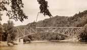 Mass Pike Bridge Construction The bridge for the Mass Pike crossing the Chicopee River, early 50's photo.
 Mass Pike Bridge Completed The completed bridge for the Mass Pike crossing the Chicopee River, early 50's
photo.

 Old Barn Not sure where this barn is (was?). Although it cannot be discerned in this low resolution web
image, the sign on the barn says "Reduce Speed NUDIST CROSSING ahead". An interesting note: I looked at the
web statistics for my pages, and this page (Wilbraham History) is getting approximately 65 hits per month from
people who are searching on the string "nudist". This page is the only page in my 150 MB of data that contains the
word "nudist". I suspect what some web surfers are seeking is not what is found on this page!
 Minnechaug Sign The original Minnechaug sign.
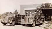
 Fire Department, Early 1950s A view of the Fire Department and two trucks from the early 1950s.
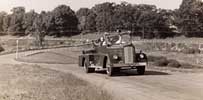
 Fire Truck at Memorial School A fire truck driving up the road to Memorial School; the photo is from the
early 50s as Memorial School was built in 1950.
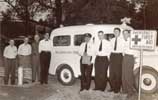
 Ambulance This photo I had little info for, other than it was a photo of an early ambulance. However
visitors to this site have generously provided some info: This was not just an early ambulance, it was the first ambulance in town. It was bought in 1950 or 51 I believe, and operated by the Fire Dept. Hence, in the
picture, the guy with the hat is Chief Ralph Tupper; right next to him is Red Dorey, who used to operate a store
across from Skorupski's (today that kind of store would be something between a deli and a convenience store); the
guy at the back of the ambulance with the dark bow-tie is Walter Howe. He lived on Vista Lane (off Main Street) and was a volunteer fireman and medic (they were all volunteer firemen in those days). I went to school and palled around with Walter's two suns, Jeff and Gerry. Also, Cliff King is standing to the far left. (Thanks Al!) Also, some more info from another long time resident: The names of the men standing by the old White Dodge Ambulance are as follows: The first 3 from left to right I can't remember, but the fourth one is Walter Howe. Next is Chief Ralph Tupper, Red Dorey, (Owned Dorey's Quality Market where the tattoo place is now), Roger Whitehill who lives across from Grace Union, and George King who lives on Main St.. (Thank You Larry!)
 Cold Spring The "Cold Spring". I have no idea of where this was, but it apparently was located at a place
where thirsty travelers could take advantage of it! A visitor offered the following info: The spring photo
looks like the one where the water runs across Boston road (formerly called the Dugway) just before Bready's old
place. We used to get spring water there when we were building the house on the mountain. (Thanks Larry!)
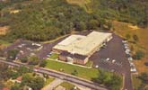 Friendlies Ice Cream Plant As seen from above. Photo probably from late 1960's.
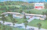 Wilbraham Motel As seen from above. This image is apparently a colored drawing, if true to what existed at
the time it is from the late 50's or early 60's as the Parkway Drive In Theatre screen (shown here with the
Wilbraham Motel sign) is present.
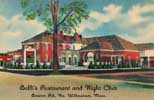
 Belli's Restaurant A favorite "hot spot" for Wilbraham residents in the 40's and 50's. The building is still standing today but has had no successful tenants recently. After Belli's, this restaurant had the name "Ground
Round" and at least one other name I cannot recall. A former Wilbraham resident wrote and provided the following
info: Belli's was definitely a hot-spot in the 40s and 50s, and pretty much defunct by the 60s. First it was a great restaurant, run by the Belli and Richie (sp?) families. Two or three
generations. Aldo and Lena Belli were the genial host/hostess. Tino Belli, a brother was associated with the
restaurant for a time, then bought a package store in Winchester Square. Grandpa and Grandma Richie worked in the
back. Laurence Richie was a kid somewhat older than I who lived and worked there as well. I believe Laurence went
to Wilbraham Academy. Anyhow, the place had Floor Shows and music several nights a week - combo, comic and stripper. It was a great place in those days. My folks were friends of the families, and I am told my first stop on the way home from being born at Ludlow Hospital was Belli's...so they could all admire me. I'm also told, my first solid food was spaghetti, there at Belli's. I know that was always one of my favorite places to go to eat as a little kid. (Thank You Al!)
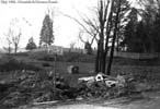 Glendale and Monson Road Improvements, 1954 Work in progress to improve the junction of Glendale and Monson
Roads, 1954. Photo contributed by Bruce Tingle. Picture from a collection of Henry Edson, author of a couple of
Glendale memoirs and the creator of a large historical map hanging in Town Office.
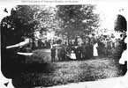 Glendale Cemetery Veteran's Boulder Ceremony, 1913 A photo of the ceremony held at Glendale Cemetery in 1913. Photo contributed by Bruce Tingle. Picture from a collection of Henry Edson, author of a couple of Glendale
memoirs and the creator of a large historical map hanging in Town Office.
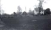 Heiden Farm A visitor of this site sent me this image and writes This photo of the Heiden Farm, was taken
many years ago, from the Mass Electric sub-station front yard, at Main St. and Church lane, looking (West) across
the street. The house is approximately where the Minnechaug driveway is now. Their frontage was between Church Lane
West ( no longer exists) and the house to the right of Minnechaug’s entrance road. Church lane originally crossed
Main St. It separated the Merrick Farm from the Heiden Farm. The only remains are a lot of brush and a gate blocking it, across from the only remaining Church Lane. There was a house on Church lane West belonging to Mrs. Benoit.
After the school was built, vandals burned her house down while she wintered in Florida several years ago.
Thank You Larry!
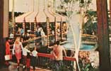 Eastfield Mall Gazebo Court 1970 OK, I know it's not in Wilbraham... however, Eastfield Mall is significant
in that it was the first mall of its type in this area. Many Wilbraham people spent a lot of time here, so I
decided to include this photo. Remember the two large fountains? How much this mall has changed. Remember the "Flaming Pit" restaurant? How about the movie theatre with 2 screens! Remember the entrnace canopies with the big letter "e" on them? Remember Steiger's? Remember McCrory's? Remember the two large fountains? I miss the fountains, the decision to remove them was not a good one in my opinion... (probably cost too much to maintain and operate).
 Henry Labroad and his wife Ann Collins Labroad Photo donated to this site by Dave Ashton.
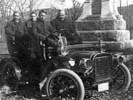 At Soldier's Monument Fred R. Collins, passenger and owner of the 1905 Cadillac and uncle of George Labroad (driver). Backseat occupants are George Labroad's cousin's Lois and Leslie Hathaway, grandsons of Richard Collins and Caroline Clark Collins. Photo donated to this site by Dave Ashton.
 Catherine and Martha Egan (daughters of James Egan and Mary Foley Egan, owners of Egan's Store). Martha Egan is the future wife of George Labroad. Photo donated to this site by Dave Ashton.
 Dora Labroad Morgan, Martha Egan Labroad and Ester Money Photo donated to this site by Dave Ashton.
 Wilbraham Coins Front and back views of two Wilbraham coins. Photo courtesy of Walt Damon.
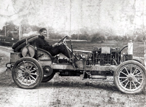 Knox Race Car One of two cars that were raced up Monson Road in the early 1900s. Photo courtesy of Walt Damon.
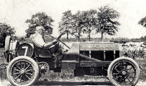 Knox Giant The second of two cars that were raced up Monson Road in the early 1900s. Photo courtesy of Walt Damon.
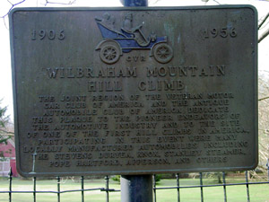 Wilbraham Mountain Hill Climb A sign near the bottom of Monson road that documents the race up "the mountain" in the early 1900s. Photo courtesy of Walt Damon.
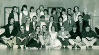 Wilbraham Community Theatre Cast The Wilbraham Community Theatre for sure existed in the early 1970s however I do not believe it exists today. This is a photo we had from one of their productions. Unfortunately I only know the names of a handful of people. They are: Back row, far left - Bill Polari. Back row, fourth from left - Penny Riddle. To her right is Joe Roberts.
Note: I have more photos to add... lack of spare time is main enemy... page will be updated as time allows!